Tuesday, September 11, 2018

Hiking Secton H of the PCT: Days 7 & 8

Day 7: Trail Magic!
  • Woke up to a busy campsite w/ 4 other campers, plus us, but by the time we'd had out decadent breakfast of omelets & potatoes (thanks Sarah!) they'd all cleared out.

  • The trail for the first half of the day was uneventful, maybe even underwhelming, and I was sore from all our hiking. 
  • starting the previous day, we'd begun hearing that there was "trail magic" on the road ahead of us, and this morning we'd learned it was a group of people who had set up camp and were giving out taco, watermelon and other goodies. 
  • We were very excited when we finally came across them.
  • Tacos! And watermelon. 
  • "And we also have pot here, if you're interested."
  • Sat in lawn chairs eating and listing to an Australian woman talk about her misadventures: "So, in one weekend, I rode with a woman who dresses as sasquatch and got invited to a UFO sighting. Welcome to America!"

  • Tummy's full, we set off again. We'd covered a remarkable 9.5 miles in the morning and only had 5 or so for the afternoon. 
  • Entered Indian Heaven Wilderness.
  • Go to watch NoBo (Northbound) hikers' faces light up when we told them about the trail magic ahead. 
  • Like previous day, my left knee started giving me issues, but soon enough we'd reached the turn off to the lake we would camp at. Ended up camping at side lake. Small & weirdly warm. 


  • Super cold and misty / a little rain, but Sarah made an amazing, warm curry dish, which helped us through the evening.


Day 8: Soggy!!
  • Woke up to a misty, cold morning. My knee still bothered me, so I wasn't excited about start.
  • As we set off mist switched to actual rain at times, but dampness encouraged us to make good time. 
  • Trail set up so the we rarely saw anything of interest. Instead just junctures with signs pointing off announcing a lake or hike.

  • Reach a point where we were on the edge of a ridge, which one side was dry-ish and the other was blasting rain. 
  • Had quick lunch on the dry portion of the ridge.
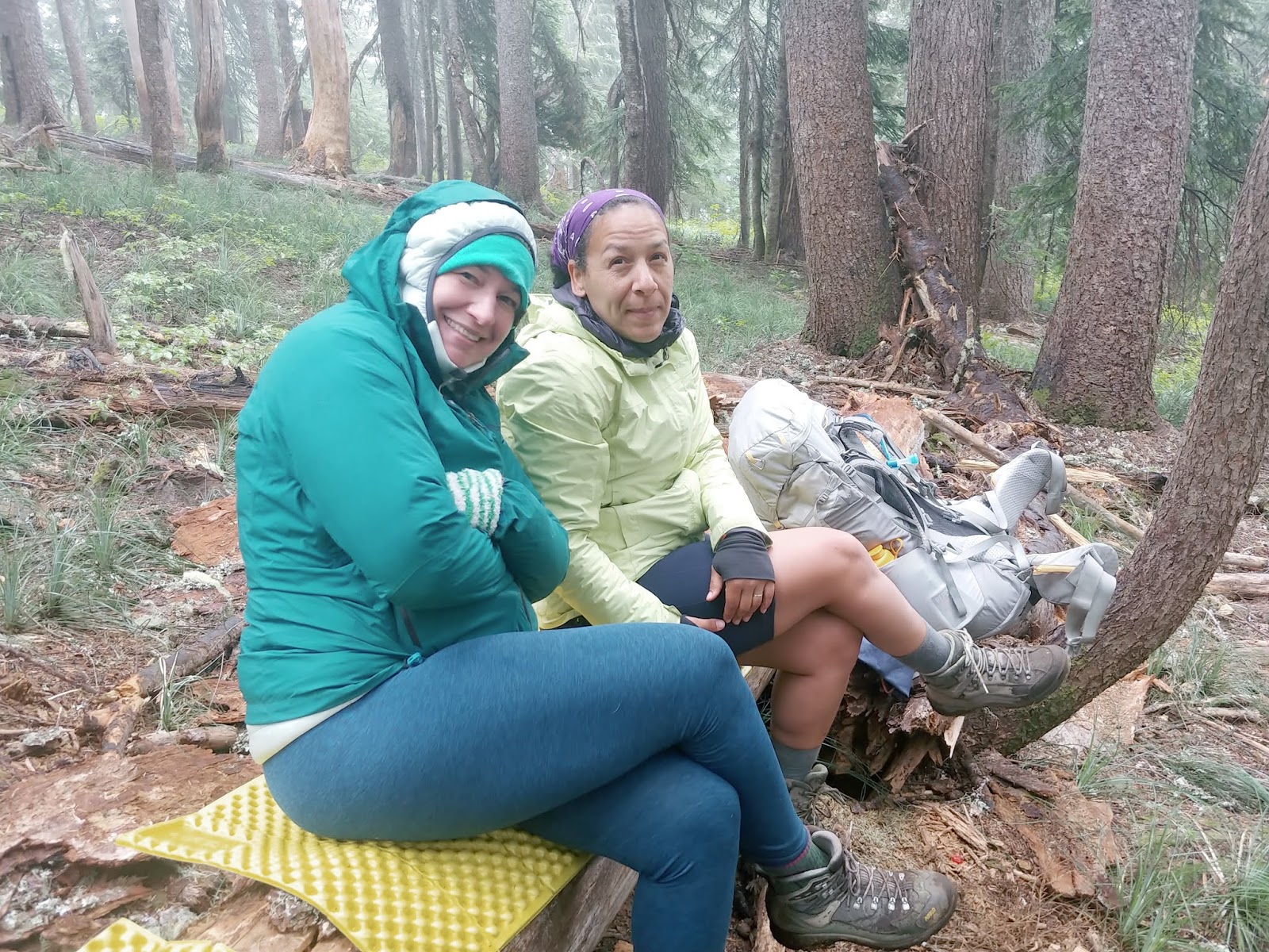
  • Began descent to a horse camp. Ambika, eager to be done, rushed ahead. Long flat section after switchbacks, ending at parking lot.
  • Across the street was the camp, including pit toilets. But, decide to move on because there is no water. 
  • At camp encounter older SoBo couple. She's friendly but he is... odd? Prickly?
  • Continue on over lava fields, with rain increasing. Keep leap frogging with SoBo couple. 

  • Reach first place we "think" there is a camp, but it's just a pipe w/ well water. 
  • We decided to try for a second camp an additional 2.3 miles away (brining us to mearly 5 miles more than planned).
  • We make it to the camp site, which seems surprisingly dry, with a small spring. And, after a good pasta dinner, things feel positive again.

Monday, September 10, 2018

Hiking Section H of the PCT: Days 5 & 6

Day 5: Mt. Adams


  • Woke feeling well rested after sleeping next to the white noise of the river. 
  • Begin gentle upward hike towards Adams, getting our first good views!
  • Views continue to improve including... Looking back to the Northwest we can finally see Mt. Rainier!
  • Scenery is wonderful, idyllic sub-alpine terrain, w/ rolling hills, babbling streams and stumpy trees. 
  • Always Adams towering above. 
  • Take our first break on boulders, with view of field and Adams. Below a trio of hikers does yoga.
  • Further walking takes us to a "difficult water crossing." A rough-shod bridge made of a dozen branches, over a roiling, grey river.
  • Further on, we reach a lava field which is a sea of black boulders. See our first horses. 
  • Take our lunch next to a nice, little stream, which we cross to move on.

  • Afternoon break is at Sheep Lake (another Sheep Lake) where we talk at length with a mysterious, mournful man. Beyond that is a death march through a lovely but sad tree graveyard. The result of a forest fire. ("Death march" in only that it was hot, we were getting tired and it seemed to go on forever.)
  • Rainier fades from view, but we can now see St. Helens and even (Mt.) Hood. 
  • Hoping for water, we diverge from the PCT a few hundred yards, onto Horseshoe Meadows, and set up camp next to a silty creek. Next to Adam and Margie, a talkative couple we met earlier and who are hiking around Adams. (This campsite highlighted something about thru hikers. They are all using an app called Gut Hook to get their information about the trail. But, it only provides info about things on the trail itself, so we found that, if you located a camp site or water source that was even a few hundred yards off the trail, the thru hikers would be completely unaware of it. Like trail tunnel vision. Trail Vision.)
Day 6: Halfway There! Restocking Food & Supplies

  • Woke up this morning sooooo cold. "The ice planet of Hoth!"
  • Then stove broke, so no hot breakfast. 
  • We all cheer when the sun crests Mt. Adams. (Heat!)


  • Quickly make our way down, down, down. Through more old forest fire damage. Snacking on berries. 

  • Make good time, barely breaking and arrive at the road we were planning on meeting Joe. 
  • Hang out, talking to the man who is parked there, giving out fruit and snacks to the hikers. Waiting for his son & friend to come along... which the eventually, heartwarmingly do. 
  • Joe arrives! Photos of the kids are shared. Then we ask him to give us a ride down to Trout Creek to get supplies & a new stove. 
  • First stop a small general store where we sort through our food (in the stores parking lot). We are sending a lot back. with him.
  • Then head on to a Hardware store, where -even to the owners surprise- Sarah finds a tiny camp stove. We are back in business!
  • Joe gives us a ride back to the trail, we split a beer, say goodbye and start hiking up the trail.
  • Lots of ups and downs. 
  • Late lunch in a sunny field, making awkward conversation with a hiker.
  • My right knee starts acting up. 
  • Find our camping spot, wedged between to streams. 
  • Sadly! Sarah gets stung by a yellow jacket. 


Sunday, September 9, 2018

Hiking Section H of the PCT: Days 3 & 4

Day 3: Cispus River
  • Bad night of sleep. Very windy. 
  • Still windy in the morning but... the smoke has been blown away!
  • After a cold and windy breakfast, we set off, feeling optimistic because of the blue sky. 
  • After a couple of #blessed campsites, we see the Cispus River Tributary, a giant bowl fed by the Cispus River and several smaller rivers - and we can see it because of no smoke! (The "#blessed" comment is a joke we made regularly on the trail to describe campsites that might have amazing views, which you'd want to photograph for Instagram... but you'd never actually want to camp at because they were small and/or perched on a cliff.)
  • Stumble across surprised waterfall. 
  • Cross Cispus River and begin climb out of tributary (a basin, really, I think the map referred to it as a "tributary" so I kept using the word).
  • Another climb leads to another amazing valley, this one on the Yakima Reservation. 
  • Signs that read "No trespassing. Stay on trail."
  • Crazy hexagonal rocks push out of the earth, their broken off chunks looking like columns. 

  • Leaving the Reservation leads to a long, straight path which dominates the middle of the day. Hot!
  • Lunch at Sheep Lake. Lunch & wading. Dead salamanders. (We would hike pass enough Sheep Lakes on this hike that it became a bit of a joke. "Is there just some sort of itinerate sheep that travels between all the Sheep Lakes?)
  • After long straight march, break at Walpus Lake trail turn off. Old man with torn white hat finds a campsite and asks us to deliver a message to the "Czech & Polish girls behind me." (We had presumed they were friends, but when we later ran into the girls, who were significantly younger and quite attractive, they seemed perplexed. "We just met him this morning.")
  • Rest of the day is easy, flat walk through large trees. Ambika and Sarah talk the whole way. I'm exhausted from all the hiking and bad sleep. 
  • Camp at curve in trail, next to small stream. (There ended up being a bees nest in the site, but they seemed docile.)
Day 4: March to the Lava Field
  • Woke up after decent nights sleep and weird dreams.
  • Made breakfast of hashbrowns with spam and peppers. (Sarah, Ambika and I had divided meals up, so that we took turns with breakfasts and dinners. But, Sarah ended up planning mine and cooking over half of them. Because I'm spoiled rotten.)
  • First half of the day, made great time, doing 5 miles before noon, through flat forests with lots of lakes and mushrooms.
  • First lunch at lake side campsite. 
  • Second lunch at small idyllic stream w/ frogs. (Which we named.)

  • Left Goat Rock Wilderness, crossed a small dirt parking lot and entered a hot, dry forest where the path stretched straight as an arrow, seemingly forever. Only thing breaking it up was a gravel road that also stretched straight in both directions. 

  • Finally, through the trees, we began to see the lava field, which looked like a wall of boulders stacked 50ft high and running in each direction like a wall built by giants. 
  • Beyond that, hazy in the distance, we could make out the white peak of Mt. Adams.
  • Shortly, we arrived at Lava Springs, a section of the wall where spring water emerged from beneath it, and a stone bridge over the resultant stream. 
  • Talked with friendly Northbound section hikers who told us about a "short cut." Also, a crazy yerba matte drinking guy w/ a dog. 
  • A half mile hike uphill took us to our campsite next to the raging, brown, silt-filled Mudfork River.

Saturday, September 8, 2018

Hiking Section H of the PCT: Day 1 & 2

So, last month, Sarah and I, along with our friend, Ambika, hiked Section H of the Pacific Crest Trail. Section H is approximately 150 miles long, and stretch from White Pass in the North (just southeast of Mt. Rainier) down to the Bridge of Gods on the Oregon border.

Sarah and Ambika, two years ago, had hiked Section I, directly north of Section H, but this was my first backpacking trip longer than 3 nights. It was intense, amazing and challenging both physically and mentally. And, while I'm still not sure I'm cut out for hikes that long, I'm glad that I did it and proud to have completed it.

To help navigate, I had printed out a series of Half Mile Maps, which detail the route, and most of the water and campsites to be found along the way. Each day, I would write notes on the back of one of the completed map sections, detailing what we'd experienced. I though it would be fun to transcribe those notes here, along with posting some pictures, and including some additional details. (In italics, with parenthesis.) This might not be as detailed, but I thought it might be fun and more immediate seeming.


Anyhow, let's get started...


Day 1: Smokey!

  • Because of the fire, we started on a detour. Which turned out to be much longer. (There was a forest fire, near White Pass. So, the Forest Service had detoured the PCT onto a side trail, to keep people at a safe distance.)
  • Saw first thru hikers. (We were going Southbound, while most of the people doing the entire thing -aka "thru hikers"- go Northbound.)
  • Steep drop to a river crossing. Getting our feet wet.
  • Trail splits w/ singage from the Forest Service, collapsed cabin and a woman w/ air filter. 
  • Little frogs.
  • First person we talked to was a hunter, after lunch. Awkward conversation while he held a rifle. First indication that detour trail was longer than we thought.
  • Pass a tiny pond & camp site. Then cross a field toward and amazing and stunning bowl. 
  • People getting tired as we climb to Lost Hat Lake. At Lake more water & wade. 
  • Fish heads! (Someone had obviously done some fishing in the lake.)
  • "Have you seen a young oriental dude?" (This was a question that we were asked, while at the lake, but a thru hiker that looked like a malnourished Santa Claus. We had a bit of a "did he just say that?" moment. But, because he was older, looked like Santa Claus and seemed to be friends with the person in question, we just told him "yes" and pointed him in the direction his apparent friend had gone.)
  • After lake, more up-up-up. Across steep grass field, with view spread out in front.
  • Reach view point, run into a hiker from Florida who gives us a ton of info about distances, camps, etc. 
  • As we descend through old forest fire white trees toward Lost Lake, I'm in rough shape.
  • Rest & stretch at Lost Lake. 
  • Easier going. Flatter. Walking along ridge. 
  • Got water at creek and Ambika falls in.
  • Walk to campsite... which has a creek... that may have been the actual creek. (We had heard there was a creek to get water at, and had presumed that the creek Ambika fell in was the creek. But, it was small and muddy. This creek, was probably the actual creek hikers had mentioned.)
  • Exhausted. Beans & rice!!
Day 2: Knife's Edge!
  • Long straight hike just below a ridge. No view because smoke, but several friendly and mostly female hikers. (Ambika and Sarah had mentioned that it was mainly men on the trail. But, as I note here, we saw a lot of female hikers. The demographics are apparently changing on the PCT.)
  • Move to top of ridge, revealing huge arch of fallen stones, echoing w/ sounds of grasshoppers.
  • Descend to Packwood Saddle, which was our planned destination for night 1.
  • Steep climb up mountain side, across fields of wild grass. "Imagine having to mow that!" (A bad joke I kept making.)
  • Begin getting impressions of stunning views of "Egg Butt" and beyond.
  • Finally, after a day and a half, reach the official PCT. Have lunch at detour/PCT sign, before beginning climb to Knife's Edge. See southbound hikers in silhouette on mountain top. 
  • As ascending to Knife's Edge, see mountain goats lounging in snowfields. 
  • Path narrows to ledge before reaching.
  • Knife's Edge is amazing! A winding path along a steep mountain ridge, up to "old snowy."
  • Ambika is not a fan, and sets off just trying to get it over with.
  • Sarah not a fan of my attempts at humor. 
  • Reaching the other side, we encounter a crew fixing the trail. Very grateful for their work moving the "singing rocks." (I was calling the rocks "singing rocks" because the clattering, as we walked over them seems strangely musical.)
  • Cross several small snowfields and watch one of the clean up crew bathing in a pool of snow water.
  • Beginning to head down through beautiful, scenic rock and grass fields with amazing boulder formations. 
  • Pass the "Muppet Kingdom," a giant split boulder w/ muppet-like flowers around it.
  • Discover an amazing freshwater spring and -after refilling water for the first time that day- double back to a campsite we'd seen.