Tyler Reporting
Continuing my explorations of South Seattle, with our dog Cleo, during near-daily 2-3 mile walks.
Weeks 13 & 14
We started this pair of weeks by finishing out the Leshi quadrant, and braving the braving the I-90 floating bridge out to Mercer Island and back. Unfortunately, it ended up being our first rainy day in a long while, and hiking roughly 5 miles along a busy freeway, in the rain is about as glamorous as it sounds.
After that, we moved back South, to the Rainier Beach area. This quadrant proved to feel like the Tale of Three Cities. On the west side, you had the sleepy, suburban south end of Beacon Hill, in the center Rainier Valley with its string of immigrant (mainly East African) restuarants and businesses, then on the East edge, along Lake Washington the giant affluent houses with their gated driveways. It definitely made for an interestingwalk, when my route did go West to East.
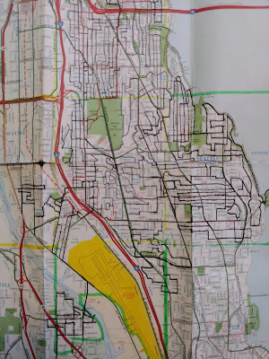
Most of our exploring over the last two weeks has been in the Southeast corner of this image.
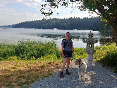
First time leaving Seattle proper on our walks. Just swung by a nearby park to let Cleo take care of some business... then back across the bridge.
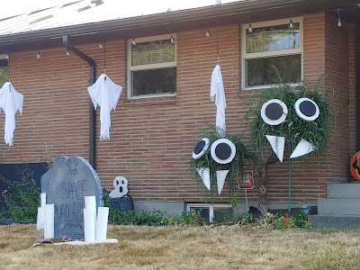
Fun signage on the median between two curving roads. Also, note the Halloween decorations going up. Weird to think I started these walks back in June.
Construction along Rainier Avenue. I appreciated the nod to the Ethiopian flag.
Cleo... staring super-intently at yet another cat.
Entering Rainier Beach. Running out of Southeast neighborhoods, before hitting Seattle's border with Tukwila.
I liked the little windows on this gate, made from old Donkey Kong video game screen-frames.
Saw this lost dog sign on a couple of occasions, and I hope the owners found him eventually. But, also bemused by the vaguely existential tone of a sign reading "Lost Chance." Lost chance at what?!
A giant, inexplicable statue face, sitting on top of a storage container on an anonymous residential side street.
These signs went up early in the pandemic, to give people more options to go outside, during social distancing. I always wonder if anyone *really* used them but will say they make nice streets to walk down with Cleo.
Likewise, these greenways and bike routes make good dog walking routes to. Usually comparatively flat and quiet.
Likewise, these greenways and bike routes make good dog walking routes to. Usually comparatively flat and quiet.
Weeks 15 & 16
Tyler & Cleo Explore South Seattle - Weeks 15 & 16: This two-week chunk started with us wrapping up the Southeast quadrant we'd been working on, venturing south of Rainier Beach and over to the edges of one of my favorite parks in Seattle, Kubota Gardens.
Today, we jumped to the Northwest, into the long stretches of warehouses, business parks and homeless encampments that is SoDo.
The current state of the map. All the walks for the last two weeks have been spread amongst the far SE, SW and NW corners.
Here's Beacon Ave. It amuses me up that, Beacon Ave reappears south of Beacon Hill, but here it is effectively a country lane. To the right are horse pastures. Just surreal this is Seattle.
One of my two walks in South Park this time around was through a very industrial wedge of it. All cranes, factories, shipping and business.
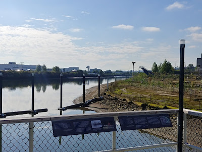
Another small pocket park on the Duwamish, with a traditional tribal name. There's actually an impressive number of these, but there are largely all wedged into areas with comparatively little pedestrian traffic.
Adding another twist to the more industrial part of South Park, it's also undergoing a lot of road improvement... making it quite a maze to navigate.
Adding another twist to the more industrial part of South Park, it's also undergoing a lot of road improvement... making it quite a maze to navigate.
While the large houses along Lake Washington could be described at mansions, that large houses of South Park are more ramshackle and almost seem to be growing organically.
Obligatory Beastie Boys mirror self-portrait.
The houses and streets of Highland Park are pretty generically suburban. So, I found myself taking more photos of the Halloween decorations that are cropping up.
Mysterious towers near Westcrest. Note, that's not fog, it's smoke from all the recent forest fires. I even ended up wearing a mask a couple of day, the air was so choked with smoke.
Driveway street art.I was sort of charmed by how the sidewalk goes around the tree. More of this, please.
I'm not sure how or why the back of the sign got painted, but I thought it was kind of a cool way to activate an ignored space.
An auto shop in SoDo. I love how they've made a life-sized model car sprue.
That said, as I reenter SoDo, where the situation is probably the worst, I felt that I should acknowledge that streets like this are all too common. Unfortunately, there doesn't seem to be the political will or resources to find a compassionate solution to the situation. Instead, the city seems to rely mainly on regular sweeps of camps, that seem both cruel and only push the problem around. Meanwhile, underfunded services struggle to even find places to operate in a city that suffers from extreme NIMBYism; and more and more people get pushed onto the streets through Seattle's astronomical housing prices and the current drug crisis. It's tragic on so many levels.


