
Tyler Reporting:
Continuing my explorations of South Seattle, with our dog Cleo, during near-daily 2-3 mile walks.
Weeks 9 & 10

These last two weeks explorations have been slowed a bit because of both a mid-week camping trip and some ongoing knee issues I'm having. Still, we managed to wrap up the Seward Park Quadrant, before moving on the new quadrant to the south, where we explored a wedge of Beacon Hill, around Boeing Field, and into South Park. We even picked up a bit of Georgetown/SoDo yesterday.
You know what area I really enjoyed? South Park. When Sarah and I first moved to South Seattle 14+ years ago, we had a running joke to the effect of "you know you are lost when you realize you are in South Park." But exploring it this week, it reminded me a lot of what appealed to me about Georgetown and Beacon Hill years ago: Diverse, working class and with a noticeable funky, artistic style. Plus, I think it's Seattle's only real community ON the Duwamish.


A rare self-portrait of me. Taken in the Rainier Valley.

A typical house and view in the Seward Park/Brighton Beach neighborhood.


A mural on a Safeway near the Othello Station.

I've got a weird obsession with Military Road. Originally built to connect Fort Steillacoom and Fort Bellingham, in the 1850s, before Washington was even a state. It pre-dates any urban planning, and the remaining sections of it always run counter to any current grid system. This section is on Beacon Hill, but I've encountered other sections farther afield.
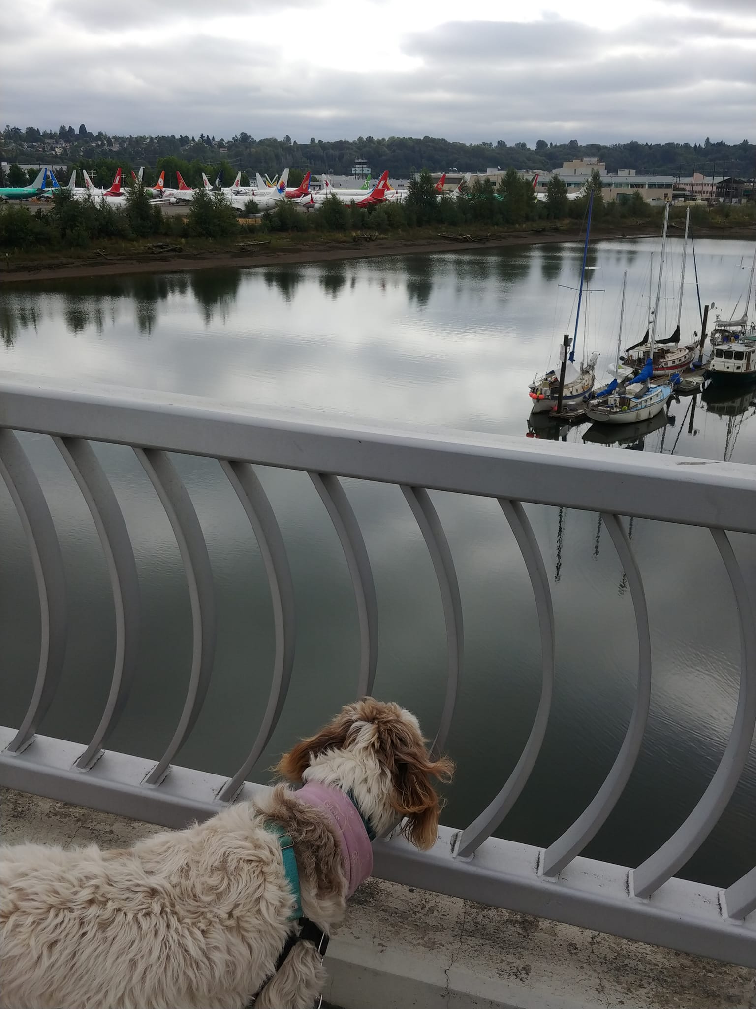
Planes and boats. Crossing the South Park Bridge over the Duwamish. When Sarah and I first moved to South Seattle, this bridge was closed, making it feel like South Park was cut off from the rest of the city.

A pedestrian underpass beneath East Marginal Way connecting two parts of the Boeing Plant.


A pocket park on the Duwamish in South Park.


Weeks 11(-ish) & 12:

The map continues to grow. Most of the growth in the southwest, but a little in the northeast.
"Week 11" ended up being spread over about 3 weeks, owing to our trip to Iceland, catching Covid and my ongoing knee issues. But we were back in the swing of things last week.
Most of the last dozen walks were exploring Seattle's SODO neighborhood, South of the West Seattle bridge. And you know what no one has ever waxed poetic about? The beauty of SODO. And for good reason. SODO is largely dominated by shipping, warehouses, long industrial strips, lined with semi rigs and tragic numbers of Seattle's unhoused population. Still, there were pockets of art and life: Murals, pocket parks and random restaurants or rogue houses left over from earlier times.
Rounding out last week, we moved on to the next "quadrant" (can you have more than four quadrants?), and we were back into the giant houses and mansions of North Mount Baker and Leshi.


A pocket park on the edge of the Duwamish River, with its original Duwamish name.


Another self-portrait of me and my walking companion.

Some of the humble houses on the North end of Mount Baker.
(At this point, I'm basically now caught up with where I am on my Facebook posts. I just posted the entry for Weeks 13 & 14 there. But I think I'll continue posting entries here in 1-month chunks. So, expect another entry here in about 2 weeks, then monthly going forward. Until I give up on this project.)
No comments:
Post a Comment